File list
From Coastal Sarasota Watersheds Wiki
This special page shows all uploaded files. By default the last uploaded files are shown at top of the list. A click on a column header changes the sorting.
| Thumbnail | Name | User | Size | Description | Versions | |
|---|---|---|---|---|---|---|
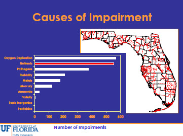
 | 17:11, 14 September 2012 | Impairment Causes.jpg (file) | Jan Allyn | 46 KB | (thumbnail for presentation) | 1 |
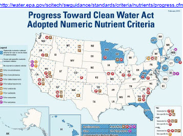
 | 17:00, 14 September 2012 | NNC Progress Map.jpg (file) | Jan Allyn | 47 KB | (map showing location of NNC adoption in US) | 1 |
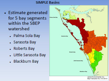
 | 16:36, 14 September 2012 | SIMPLE basins.jpg (file) | Jan Allyn | 38 KB | (thumbnail for SBEP NNC presentation) | 1 |
| 20:14, 24 August 2012 | Symposium Synthesis.pdf (file) | Jennifer Shafer | 7.07 MB | 1 | ||
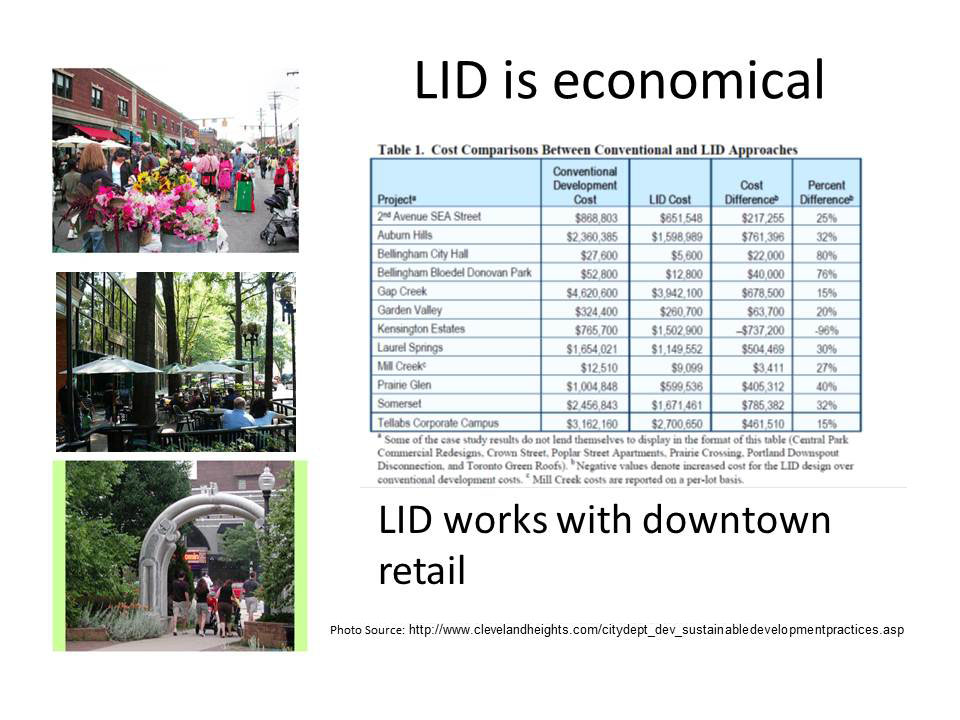
| 17:39, 7 August 2012 | LID DID.pdf (file) | Jennifer Shafer | 804 KB | (Low Impact Development in the Development Improvement District of City of Sarasota) | 1 | |
 | 17:05, 12 April 2012 | SymposiumSign.jpg (file) | Jan Allyn | 56 KB | (Watershed Symposium notice) | 1 |
| 17:12, 2 April 2012 | Historical Land Use Analysis.pdf (file) | Chelsea Flint | 1.85 MB | (smaller file) | 2 | |
| 16:59, 2 April 2012 | Watershed Planning in Sarasota County.pdf (file) | Jan Allyn | 1.52 MB | (smaller file) | 1 | |
| 15:39, 2 April 2012 | Mitigation of Nutrient Runoff in Sarasota Bay.pdf (file) | Jan Allyn | 320 KB | (smaller file) | 1 | |
| 15:35, 2 April 2012 | The Sarasota Bay Watershed Guide.pdf (file) | Jan Allyn | 313 KB | (smaller file) | 2 | |
| 22:08, 5 March 2012 | Oyster Habitat Restoration and Assessment in Sarasota Bay Florida.pdf (file) | 74.93.33.26 | 1.11 MB | 1 | ||
| 22:36, 1 March 2012 | AbandonnedFishingGear.pdf (file) | Jennifer Shafer | 1.35 MB | 1 | ||
| 22:03, 1 March 2012 | Nekton.pdf (file) | Jennifer Shafer | 943 KB | 1 | ||
 | 21:19, 1 March 2012 | PalmaSolaHabitat5.JPG (file) | 74.93.33.26 | 92 KB | 1 | |
 | 21:19, 1 March 2012 | PalmaSolaHabitat4.JPG (file) | 74.93.33.26 | 93 KB | 1 | |
 | 21:19, 1 March 2012 | PalmaSolaHabitat3.JPG (file) | 74.93.33.26 | 132 KB | 1 | |
 | 21:18, 1 March 2012 | PalmaSolaHabitat2.JPG (file) | 74.93.33.26 | 120 KB | 1 | |
 | 21:18, 1 March 2012 | PalmaSolaHabitat1.JPG (file) | 74.93.33.26 | 123 KB | 1 | |
 | 21:18, 1 March 2012 | PalmaSolaRecreation3.JPG (file) | 74.93.33.26 | 82 KB | 1 | |
 | 21:18, 1 March 2012 | PalmaSolaRecreation2.JPG (file) | 74.93.33.26 | 74 KB | 1 | |
 | 21:17, 1 March 2012 | PalmaSolaRecreation1.JPG (file) | 74.93.33.26 | 90 KB | 1 | |
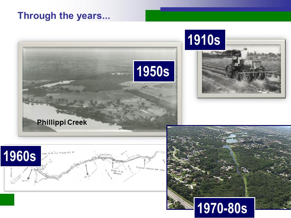
 | 21:10, 1 March 2012 | PhillippiHistory3.JPG (file) | 74.93.33.26 | 101 KB | 1 | |
 | 21:10, 1 March 2012 | PhillippiHistory2.JPG (file) | 74.93.33.26 | 86 KB | 1 | |
 | 21:10, 1 March 2012 | PhillippiHistory1.JPG (file) | 74.93.33.26 | 127 KB | 1 | |
| 16:52, 29 February 2012 | Colonial Waterbird Nesting in the Sarasota Bay Estuary.pdf (file) | 71.98.250.235 | 2.06 MB | 1 | ||
 | 14:53, 23 February 2012 | QR sign.jpg (file) | 71.41.57.154 | 68 KB | (Sign sample - shows use of QR codes to link to a video in order to further expand learning opportunities. The sign presents general information about the endangered Florida scrub jay; the video helps viewers learn more about the birds, hear their calls, v) | 1 |
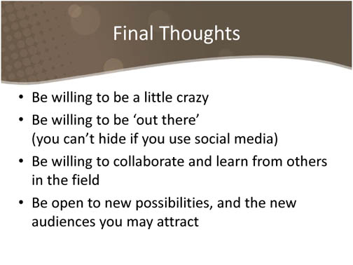
 | 14:52, 23 February 2012 | Edt11.jpg (file) | 71.41.57.154 | 61 KB | (Final Thoughts) | 1 |
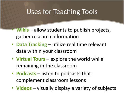
 | 14:51, 23 February 2012 | Edt10.jpg (file) | 71.41.57.154 | 74 KB | (Uses for teaching tools) | 1 |
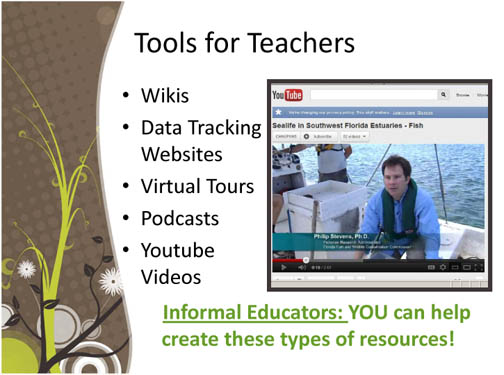
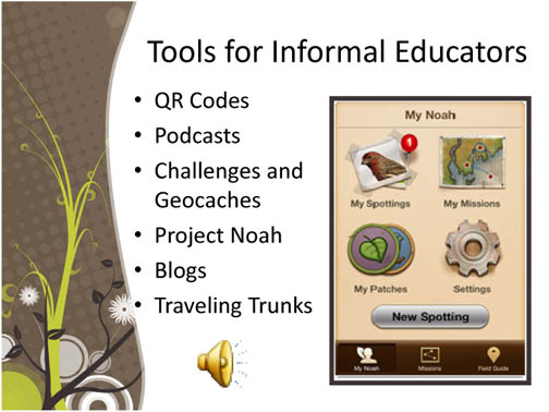
 | 14:50, 23 February 2012 | Edt9.jpg (file) | 71.41.57.154 | 76 KB | (Tools for teachers) | 1 |
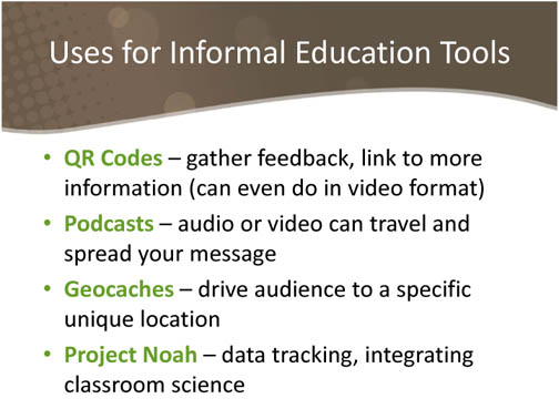
 | 14:49, 23 February 2012 | Edt8.jpg (file) | 71.41.57.154 | 69 KB | (Uses for outreach materials developed by informal educators) | 1 |
 | 14:48, 23 February 2012 | Edt5.jpg (file) | 71.41.57.154 | 71 KB | (Outreach technology for informal educators) | 1 |
 | 14:45, 23 February 2012 | Edt4.jpg (file) | 71.41.57.154 | 79 KB | (Tips for using social media) | 1 |
| 18:33, 17 February 2012 | NatureIsTheBestSolutionForBigEdwardsIsland.pdf (file) | 174.58.35.177 | 304 KB | (Protecting Seagrass and the Fishery in Roberts Bay--plus the beach on Big Edwards Island. ) | 1 | |
 | 18:06, 17 February 2012 | NatureVsEngineeringInRobertsBay.JPG (file) | 174.58.35.177 | 765 KB | (OP-Ed article in the Sarasota Herald Tribune, published Thursday April 1, 2010) | 1 |
 | 14:19, 17 February 2012 | UrbanLID3.JPG (file) | Jan Allyn | 136 KB | (modified version) | 1 |
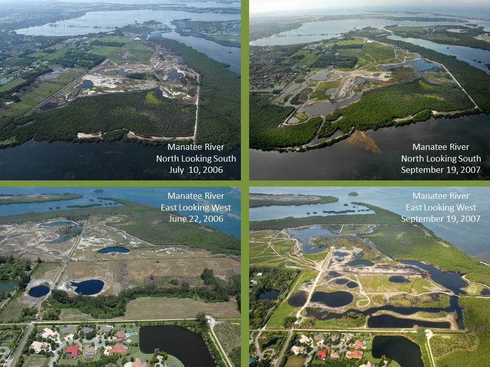
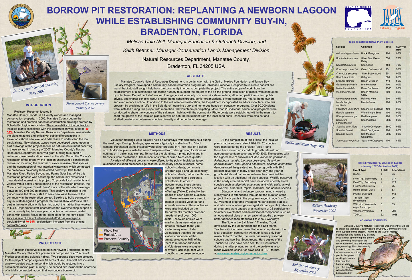
 | 02:50, 16 February 2012 | Borrow pit.jpg (file) | Jennifer Shafer | 768 KB | 1 | |
| 02:15, 15 February 2012 | Community Scallop Restoratiion.pdf (file) | 108.33.11.36 | 889 KB | (Sarasota Bay Watch has a vision for restoring the bay scallop population by using regular releases of scallop larvae into healthy seagrass beds in the region. This effort is distinguished by using private funding, planned larval releases for at least a d) | 1 | |
| 17:01, 14 February 2012 | Florida Shorebird Alliance - Floridas Shorebird Partnership Network.pdf (file) | 173.78.187.140 | 317 KB | (Florida’s wildlife habitats are facing unprecedented challenges, ranging from climate change to a rapidly expanding human population. Nowhere are these threats more concentrated than along the state’s coastline. Survival of Florida’s vulnerable seab) | 1 | |
| 16:57, 13 February 2012 | A Tidal Creek Condition Index for Sarasota County Florida.pdf (file) | 204.193.117.66 | 1.81 MB | (In recent years the importance of tidal creeks has come to the forefront of watershed management. Tidal creeks are very unique ecosystems that function as a vital link between uplanda and estuaries, and their response to watershed stressors has allowed th) | 1 | |
| 22:08, 12 February 2012 | Oystercatcher2.pdf (file) | 98.219.116.46 | 2.13 MB | 1 | ||
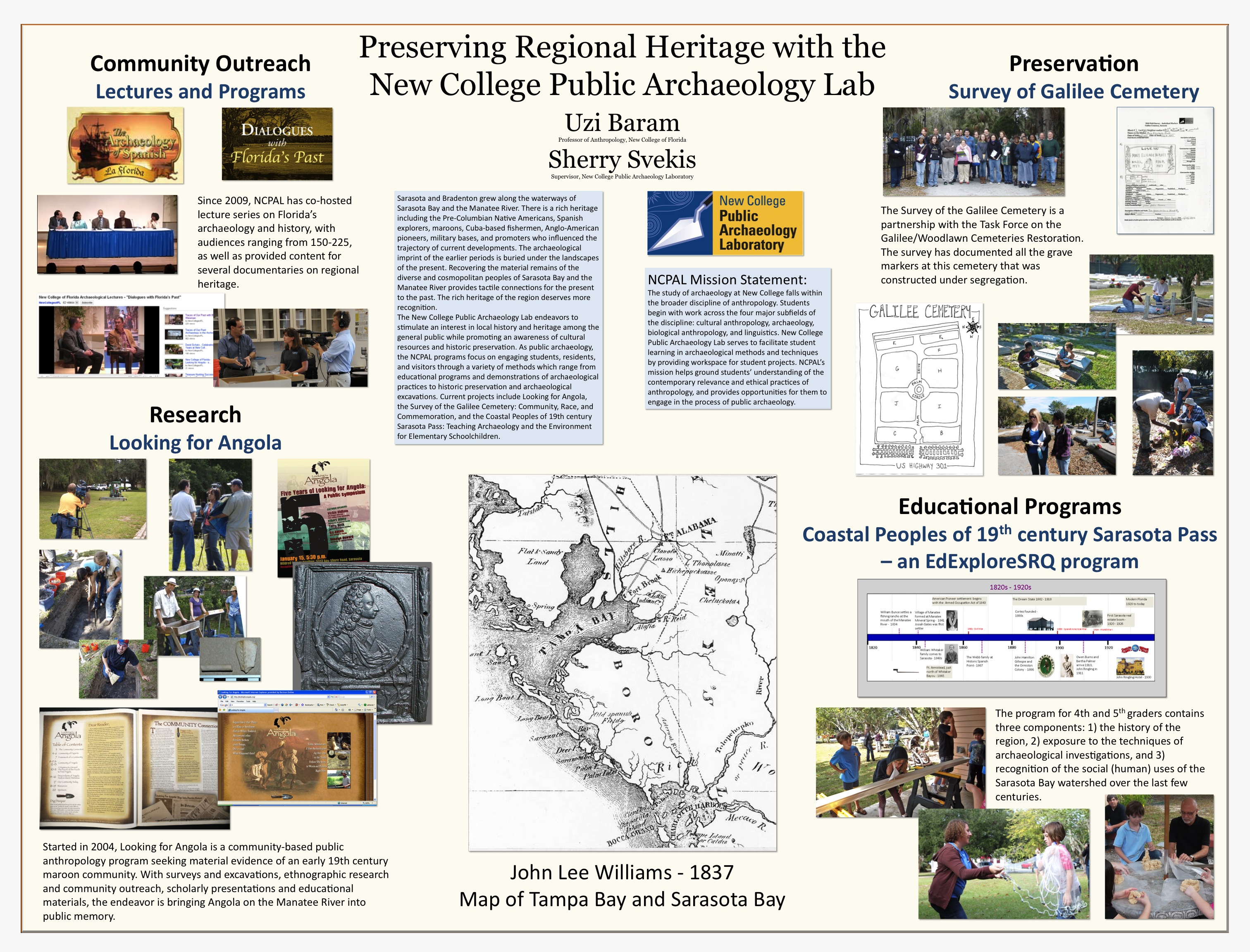
 | 15:38, 12 February 2012 | Preserving Regional Heritage with the New College Public Archaeology Lab.jpg (file) | 72.77.158.77 | 1.87 MB | (The New College Public Archaeology Lab endeavors to stimulate an interest in local history and heritage among the general public while promoting an awareness of cultural resources and historic preservation. As public archaeology, the NCPAL programs focus ) | 1 |
 | 18:27, 6 February 2012 | Conservation Foundation of the Gulf Coast - Siesta Key Preserve.jpg (file) | 71.101.89.19 | 2.26 MB | 1 | |
| 19:39, 3 February 2012 | Preparing for Sea Level Rise in the Sarasota Bay NEP Region.pdf (file) | 66.15.73.17 | 455 KB | 1 | ||
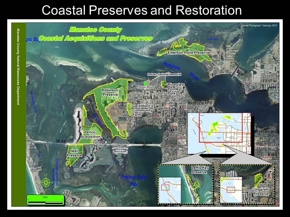
 | 16:06, 3 February 2012 | Connecting Sea Level Rise Adaptations in the Restoration Process.jpg (file) | 71.41.57.154 | 271 KB | (Manatee County's Natural Resources Department manages over 25,000 acres of conservationlan ranging from upland pine flatwoods to coastal salt marsh communities. Many of the region's most popular natural locations are susceptible to sea level rise and land) | 1 |
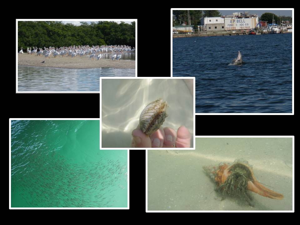
 | 01:25, 3 February 2012 | Fisheries4.JPG (file) | Jennifer Shafer | 79 KB | 1 | |
 | 01:25, 3 February 2012 | Fisheries3.JPG (file) | Jennifer Shafer | 42 KB | 1 | |
 | 01:25, 3 February 2012 | Fisheries2.JPG (file) | Jennifer Shafer | 97 KB | 1 | |
 | 01:24, 3 February 2012 | Fisheries1.JPG (file) | Jennifer Shafer | 81 KB | 1 | |
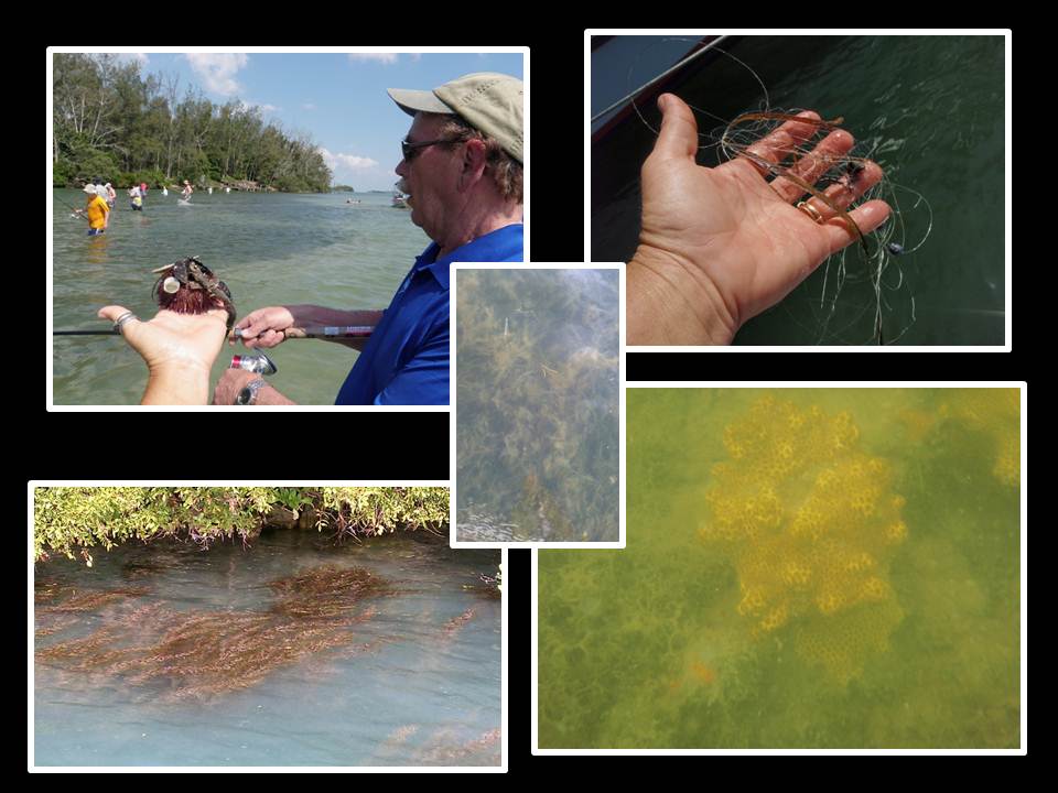
 | 01:13, 31 January 2012 | AquaticVegetation4.JPG (file) | 74.93.33.26 | 83 KB | 1 | |
 | 01:13, 31 January 2012 | AquaticVegetation3.JPG (file) | 74.93.33.26 | 69 KB | 1 |
First page |
Previous page |
Next page |
Last page |
